


Wright County PUMA, Minnesota
About
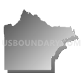
Outline

Summary
| Unique Area Identifier | 193241 |
| Name | Wright County PUMA |
| State | Minnesota |
| Area (square miles) | 714.27 |
| Land Area (square miles) | 661.46 |
| Water Area (square miles) | 52.81 |
| % of Land Area | 92.61 |
| % of Water Area | 7.39 |
| Latitude of the Internal Point | 45.17509140 |
| Longtitude of the Internal Point | -93.96639650 |
Maps


Graphs
Select a template below for downloading or customizing gragh for Wright County PUMA, Minnesota


Neighbors
Neighoring Public Use Microdata Area (by Name) Neighboring Public Use Microdata Area on the Map
- Carver & Scott (West) Counties PUMA, MN
- Hennepin County (West)--Champlin, Rogers Cities & Lake Minnetonka PUMA, MN
- Kandiyohi, McLeod, Meeker, Renville & Sibley Counties PUMA, MN
- Sherburne & Benton Counties PUMA, MN
- Stearns County--St. Cloud City PUMA, MN
Top 10 Neighboring County (by Population) Neighboring County on the Map
- Hennepin County, MN (1,152,425)
- Stearns County, MN (150,642)
- Wright County, MN (124,700)
- Carver County, MN (91,042)
- Sherburne County, MN (88,499)
- McLeod County, MN (36,651)
- Meeker County, MN (23,300)
Top 10 Neighboring County Subdivision (by Population) Neighboring County Subdivision on the Map
- Elk River city, Sherburne County, MN (22,974)
- St. Michael city, Wright County, MN (16,399)
- Buffalo city, Wright County, MN (15,453)
- Otsego city, Wright County, MN (13,571)
- Monticello city, Wright County, MN (12,759)
- Big Lake township, Sherburne County, MN (7,386)
- Albertville city, Wright County, MN (7,044)
- Minnetrista city, Hennepin County, MN (6,384)
- Delano city, Wright County, MN (5,464)
- Becker township, Sherburne County, MN (4,842)
Top 10 Neighboring Place (by Population) Neighboring Place on the Map
- Elk River city, MN (22,974)
- St. Michael city, MN (16,399)
- Buffalo city, MN (15,453)
- Otsego city, MN (13,571)
- Monticello city, MN (12,759)
- Albertville city, MN (7,044)
- Minnetrista city, MN (6,384)
- Delano city, MN (5,464)
- Dayton city, MN (4,671)
- Becker city, MN (4,538)
Top 10 Neighboring Unified School District (by Population) Neighboring Unified School District on the Map
- St. Cloud Public School District, MN (96,237)
- Elk River Public School District, MN (66,807)
- Buffalo Public School District, MN (31,756)
- St. Michael-Albertville School District, MN (22,468)
- Monticello Public School District, MN (20,466)
- Hutchinson Public School District, MN (18,208)
- Big Lake Public School District, MN (17,276)
- Glencoe-Silver Lake School District, MN (13,026)
- Litchfield Public School District, MN (11,597)
- Becker Public School District, MN (11,437)
Top 10 Neighboring State Legislative District Lower Chamber (by Population) Neighboring State Legislative District Lower Chamber on the Map
- State House District 19B, MN (59,068)
- State House District 32A, MN (55,517)
- State House District 16B, MN (52,029)
- State House District 34A, MN (47,533)
- State House District 19A, MN (47,384)
- State House District 48A, MN (45,476)
- State House District 14B, MN (40,101)
- State House District 33A, MN (39,836)
- State House District 18A, MN (38,269)
- State House District 18B, MN (37,973)
Top 10 Neighboring State Legislative District Upper Chamber (by Population) Neighboring State Legislative District Upper Chamber on the Map
- State Senate District 19, MN (106,452)
- State Senate District 16, MN (95,820)
- State Senate District 34, MN (94,255)
- State Senate District 32, MN (90,959)
- State Senate District 14, MN (86,315)
- State Senate District 48, MN (86,286)
- State Senate District 18, MN (76,242)
- State Senate District 33, MN (75,112)
Top 10 Neighboring 111th Congressional District (by Population) Neighboring 111th Congressional District on the Map
- Congressional District 6, MN (759,478)
- Congressional District 2, MN (732,515)
- Congressional District 3, MN (650,185)
- Congressional District 7, MN (625,512)
Top 10 Neighboring Census Tract (by Population) Neighboring Census Tract on the Map
- Census Tract 1008.02, Wright County, MN (13,797)
- Census Tract 1008.01, Wright County, MN (12,818)
- Census Tract 1001, Wright County, MN (12,767)
- Census Tract 269.09, Hennepin County, MN (11,806)
- Census Tract 305.02, Sherburne County, MN (11,141)
- Census Tract 304.02, Sherburne County, MN (9,292)
- Census Tract 304.04, Sherburne County, MN (8,983)
- Census Tract 1002.04, Wright County, MN (8,926)
- Census Tract 277, Hennepin County, MN (8,667)
- Census Tract 1007.03, Wright County, MN (8,470)
Top 10 Neighboring 5-Digit ZIP Code Tabulation Area (by Population) Neighboring 5-Digit ZIP Code Tabulation Area on the Map
- 55330, MN (36,440)
- 55313, MN (23,255)
- 55350, MN (18,280)
- 55309, MN (18,208)
- 55362, MN (18,089)
- 55376, MN (16,242)
- 55374, MN (13,576)
- 55301, MN (10,535)
- 55308, MN (9,064)
- 55328, MN (8,541)